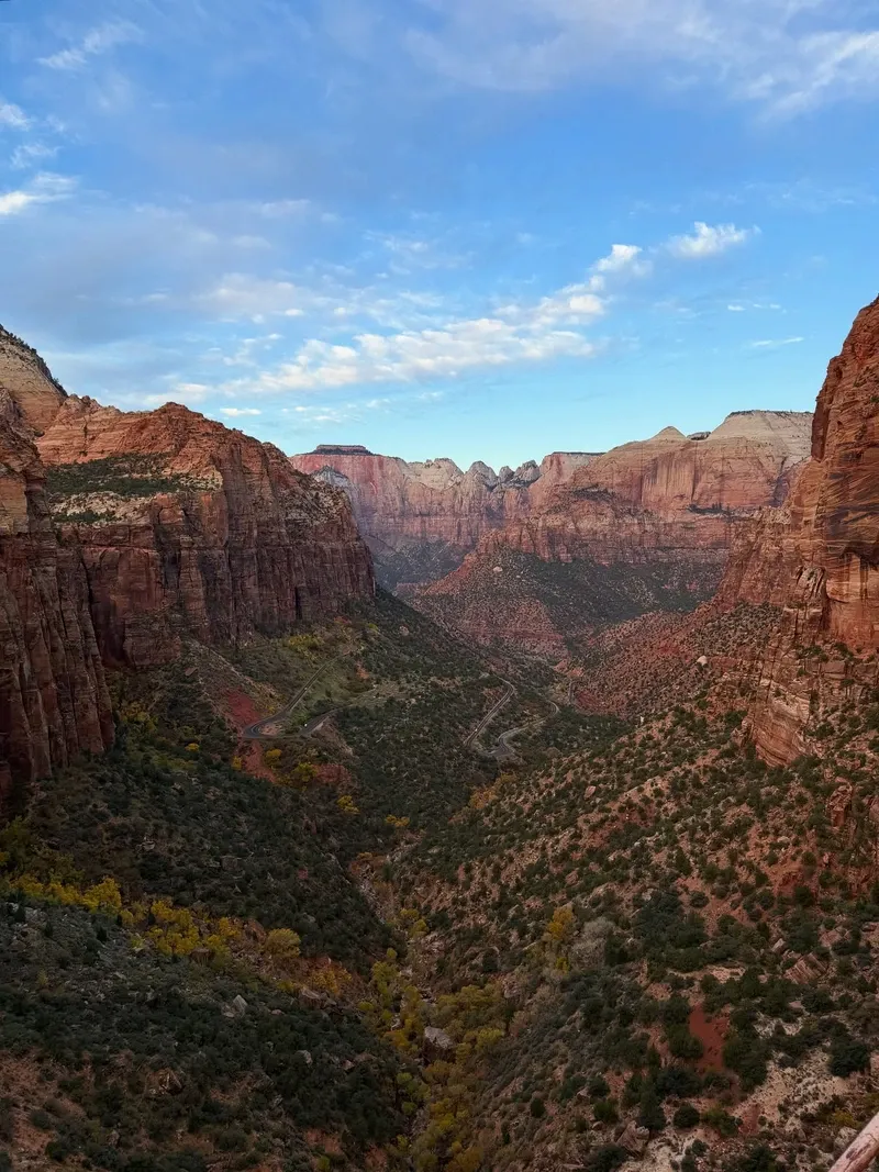
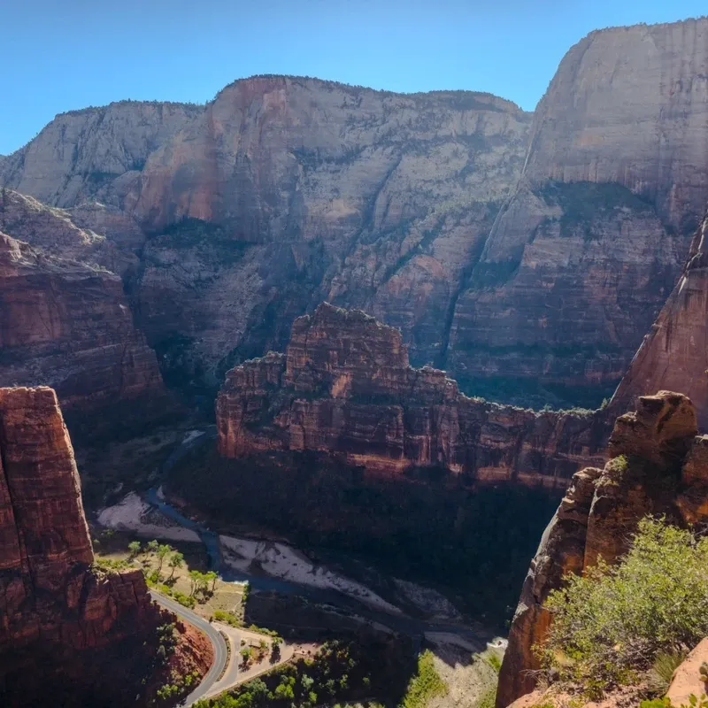
Zion National Park occupies southwestern Utah near the Nevada and Arizona borders, drawing 4.5 million annual visitors to its deep canyons and towering rock monoliths. The Virgin River carved this desert oasis, exposing millions of years of geological history in sheer sandstone cliffs.
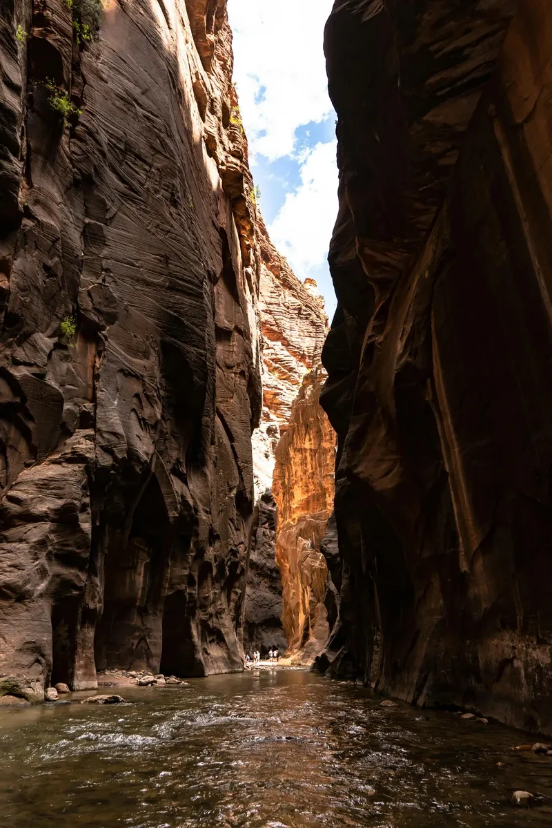
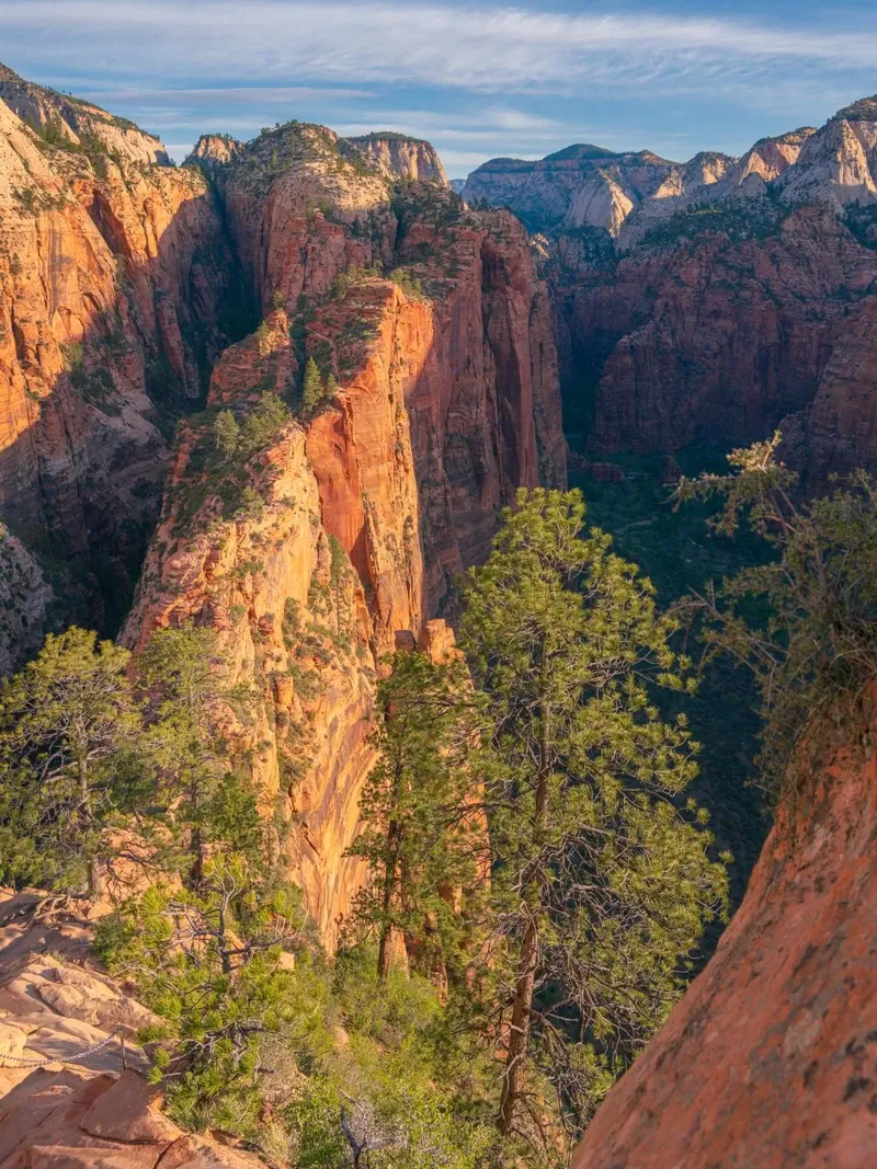
Utah's oldest national park covers a rugged section of the southwestern desert near the Nevada and Arizona borders. The Virgin River cuts directly through the landscape, carving a deep gorge flanked by sheer red and white sandstone cliffs. Hikers wade through freezing, waist-deep water in The Narrows, gripping wooden sticks to navigate the slippery, unstable riverbed. High above, the 5.2-mile Angels Landing trail forces climbers to hold metal chains along a knife-edge ridge dropping hundreds of feet on either side. The park spans varied elevations, creating distinct ecosystems that support rare desert flora and fauna.
Summer temperatures routinely exceed 100 degrees Fahrenheit on the canyon floor. Heat stroke and dehydration threaten unprepared hikers, while sudden monsoon storms trigger deadly flash floods inside the slot canyons. Toxic cyanobacteria blooms in the Virgin River pose another severe danger. Swallowing the water can be fatal to dogs and small children within 15 minutes. Standard hiking filters do not remove these toxins. Winter brings freezing temperatures and ice, making steep trails treacherous. October and November offer the most stable conditions, combining cooler temperatures with thinning crowds and changing autumn foliage.
Despite these harsh conditions, 4.5 million people arrive annually to walk the paved 2.2-mile Riverside Walk or drive the Zion-Mt. Carmel Highway. The landscape shifts dramatically from lowland deserts to forested highlands depending on the elevation. Visitors aiming to park inside the main gates need to claim one of the 350 spots at the Zion Canyon Visitor Center before 8:00 a.m. Late arrivals must pay up to $25 to park in the neighboring town of Springdale and ride the free 3-mile municipal shuttle to the entrance. The SunTran Zion Route connects nearby St. George to Springdale, providing a $5 public transit option for visitors without rental cars. The park remains open 24 hours a day, year-round, though facility operations like the Wilderness Desk and Zion Human History Museum run on seasonal schedules. Wheelchair users can access the paved 3.5-mile Pa'rus Trail, and the park equips its shuttle buses with lifts to accommodate mobility devices.
Human survival in the Zion canyon stretches back 8,000 years. Ancestral Puebloans built cliff houses and painted rock art on the canyon walls long before the Southern Paiute people claimed the territory. These early inhabitants relied on the Virgin River for sustenance in an otherwise unforgiving desert environment, cultivating small plots of corn and squash along the banks. They left behind physical evidence of their occupation, including woven sandals, pottery fragments, and granaries tucked into high cliff alcoves. European-American exploration began in 1858 when Nephi Johnson documented the gorge while searching for agricultural expansion opportunities for Mormon settlers. Three years later, Isaac Behunin constructed a log cabin on the canyon floor near the present-day Zion Lodge. He named his new home "Zion," referencing the biblical eastern hill of ancient Jerusalem captured by King David.
President William Howard Taft signed a proclamation in 1909 protecting the canyon as Mukuntuweap National Monument. The federal government renamed it Zion National Monument in 1918 to make it more appealing to tourists who struggled to pronounce the original Paiute name. On November 19, 1919, the Woodrow Wilson administration upgraded the site to Utah's first national park. Early access required grueling wagon rides over rough dirt paths originating from the nearest railheads in Cedar City. Engineers solved this isolation in the 1920s by blasting the 1.1-mile Zion-Mt. Carmel Tunnel through solid sandstone. Crews carved large gallery windows into the rock face to vent exhaust fumes and provide light. During the 1930s, the Civilian Conservation Corps constructed many of the park's modern trails, including the switchbacks leading up to Angels Landing. President Franklin D. Roosevelt later expanded the park boundaries to include the Kolob Canyons area in 1937, recognizing the geological importance of the northern red rock formations. Today, vehicles measuring 11 feet 4 inches tall or 7 feet 10 inches wide must pay a fee and secure a ranger escort to squeeze through the historic tunnel, as it cannot accommodate two-way traffic for large RVs.
Explosive popularity forced the National Park Service to alter how people move through the canyon. Administrators banned personal vehicles on the Zion Canyon Scenic Drive during the busy season from March through November starting in the year 2000. A free shuttle system now transports visitors along the 8-mile route, running every 5 to 15 minutes and stopping at key trailheads like the Temple of Sinawava. In 2022, the agency implemented a strict lottery system for Angels Landing. Climbers must secure an advance permit online to hike past Scout Lookout and tackle the final chain-assisted ascent. Rangers check permits at the base of the chains, turning away anyone without proper documentation. Wilderness camping and canyoneering also require advance permits obtained through the park's online portal.
Massive sandstone monoliths dominate the skyline across the 147,000-acre park. The Virgin River acts as the primary geological architect, slicing through rock layers over millions of years to form Zion Canyon. Water erosion exposes candy-striped cliffs of red, pink, and white Navajo Sandstone that tower up to 2,000 feet above the riverbed. At the Court of the Patriarchs, three distinct peaks rise sharply from the valley floor, named after biblical figures Abraham, Isaac, and Jacob. Visitors step off shuttle stop 4 and walk a short paved path to photograph these towering formations. The sheer scale of the rock walls creates a distinct microclimate on the canyon floor, trapping heat in the summer and funneling cold winds during the winter. Deep within the backcountry, the Left Fork of North Creek carved a tubular slot canyon known as The Subway, requiring hikers to swim through cold pools and rappel down waterfalls.
Hanging gardens cling to the weeping rock walls along the Riverside Walk and the Emerald Pools trails. Groundwater seeps through porous sandstone until it hits an impermeable rock layer, forcing the moisture horizontally out of the cliff face. Ferns, mosses, and golden columbines grow downward from these wet crevices, creating lush micro-habitats in the middle of the desert. At the Lower Emerald Pool trail, a massive rock overhang creates a trickling waterfall that hikers walk directly underneath. The water collects in a series of plunge pools that support canyon tree frogs and various aquatic insects. Mule deer frequently graze in the meadows near the Zion Lodge, while endangered California condors ride the thermal updrafts high above the canyon rim.
The northwestern Kolob Canyons section features brilliant crimson finger canyons distinct from the main gorge. This 5-mile scenic drive climbs through rugged terrain, offering access to the Timber Creek Overlook and the 14-mile La Verkin Creek Trail. Rockfalls frequently alter the landscape across the entire park. Tons of debris occasionally detach from the sheer faces due to freeze-thaw cycles, blocking trails and threatening hikers below. Anyone hearing the crack of falling rock should immediately seek shelter behind a large boulder and pull their backpack over their head. The park employs geologists to monitor high-risk cliff faces, occasionally closing sections of the Weeping Rock trail when movement is detected. Flash floods rapidly reshape these narrow corridors, moving massive boulders and stripping vegetation from the riverbanks in a matter of minutes.
The word "Zion" translates to "promised land" or "sanctuary." Isaac Behunin chose the name to reflect the safety and agricultural promise the canyon provided his pioneer family in 1861. The biblical weight of the term stuck, transforming a remote Utah gorge into a symbol of divine refuge for early Mormon settlers. For the Southern Paiute people, the canyon holds deep ancestral ties that predate European arrival by centuries. They cultivated crops along the riverbanks and utilized the native plants for medicine, food, and basket weaving. The Paiute name for the canyon, Mukuntuweap, translates to "straight canyon," accurately describing the sheer vertical walls carved by the Virgin River. Modern tribal members continue to visit the park to harvest specific plants and conduct traditional ceremonies.
Modern visitors often view the park as a physical proving ground. Scaling the metal chains of Angels Landing or navigating the freezing currents of The Narrows tests a hiker's endurance and nerve. The sheer scale of the 1,000-foot walls forces a shift in perspective, minimizing human concerns against millions of years of exposed geological time. Artists and photographers flock to the canyon to capture the shifting light on the Navajo Sandstone. Commercial photography workshops frequently target the park to capture the golden hour light hitting the red rocks. However, the National Park Service limits these groups to 12 people and strictly bans tripod use on trails to prevent bottlenecks. Nighttime photography workshops are entirely outlawed on park trails to protect nocturnal wildlife and preserve the natural darkness. The park enforces these rules to maintain the quiet isolation that drew the earliest inhabitants to the canyon. Local communities in Springdale and Hurricane rely heavily on the economic engine of the park, balancing the demands of millions of tourists with the need to protect the fragile desert ecosystem.
Drones and all other remote-controlled aircraft are strictly prohibited throughout the entire park airspace.
The Virgin River contains toxic cyanobacteria blooms that can be fatal to dogs within 15 minutes of ingestion.
Hikers must win an advance online lottery permit to climb the final chain-assisted section of Angels Landing.
Personal vehicles are banned on the Zion Canyon Scenic Drive from March through November, requiring visitors to use the free shuttle.
Large RVs and trucks require a paid ranger escort to drive through the historic Zion-Mt. Carmel Tunnel.
Pets are only allowed on the paved 3.5-mile Pa'rus Trail and are banned from all other trails and shuttle buses.
The park was originally established as Mukuntuweap National Monument in 1909 before being renamed Zion in 1918.
A private vehicle pass costs $35.00 and covers all passengers for seven consecutive days. Pedestrians and bicyclists aged 16 and older pay $20.00, while youth 15 and under enter for free.
No tickets or reservations are required for the shuttle. It operates for free from March through November, running every 5 to 15 minutes between the Visitor Center and the Temple of Sinawava.
Personal vehicles are banned on the Zion Canyon Scenic Drive during the shuttle season. You can drive your own car year-round on the Zion-Mt. Carmel Highway and Kolob Canyons Scenic Drive.
Yes. The National Park Service requires an advance online permit to hike past Scout Lookout. This lottery system manages crowds on the dangerous, chain-assisted summit climb.
Dogs are restricted to the paved Pa'rus Trail and must remain on a leash under six feet long. They are strictly prohibited on all other trails, shuttle buses, and wilderness areas.
No. The river contains toxic cyanobacteria blooms that standard hiking filters cannot remove. Swallowing the water can cause severe illness in humans and fatal poisoning in pets.
The 350-space lot typically fills before 8:00 a.m. in peak season. Late arrivals must pay between $15.00 and $25.00 to park in the town of Springdale and ride the municipal shuttle to the park entrance.
Drones and all other remote-controlled aircraft are strictly banned everywhere inside the park boundaries. Park rangers issue citations and fines to anyone violating this airspace regulation.
June offers the driest conditions for wading through the slot canyon. Summer monsoon storms from July to September frequently cause deadly flash floods, forcing sudden trail closures.
Most people spend one to three days exploring the park. A single day allows time for the main shuttle stops, while three days provide opportunities to hike deeper trails and visit the Kolob Canyons section.
Browse verified tours with free cancellation and instant confirmation.
Find Tours